Showing posts with label north east Iceland. Show all posts

Wednesday, 6 August 2014

VESTURDALUR, Hljóðaklettar & RAUDHOLAR

 ... po zobaczeniu selfoss I dettifoss kontynuowalysmy jazde dalej na polnoc droga 862. jak wspomnialam wczesniej, od momentu miniecia parkingu dedyowanego wodospadom droga zamienia sie zwiroweczke/piaskoweczke/kamienioweczke. jedzie sie raz lepiej raz gorzej, ale generalnie trzeba bylo dosc uwazac, na pewnym odcinku droga byla przeznaczona tylko dla samochodow 4x4.
 
zatrzymalysmy sie jeszcze na chwilke w holmatungur, na krotki spacer zielona dolina z widokiem na rzeczke I kilka malych wodospadzikow.
 
poznym popoludniem dotarlysmy do jednego z punktow na ktorych zobaczeniu mi bardzo zalezalo: vesturdalur I wzgorzach raudholar. z drogi 862 musialysmy zjechac ostro w dol (zjazd oznaczony) piaskoweczka I po 5 minutach znalazlysmy sie w dolinie. jest tez tam kamping.
slowo o kampingu: jest toaleta I kran z zimna woda I to w sumie tyle jesli chodzi o udogodnienia. cena za to byla chyba najwyzsza ze wszystkich kampingow gdzie spalysmy. no ale miejscowka swietna, my to wiemy, oni to wiedza wiec coz, warto :)
 
szybko rozlozylysmy namiot, zjadlysmy obiad (islandzkie klopsiki z puszki I kasza gryczana), odpoczelysmy nieco I wczesnym wieczorem wybralysmy sie na odkrywanie okolicy.
w vestuldalur szlakow jest kilka, w sumie chyba 5 opcji dluzszych I krotszych, ponadlo tedzy wiedzie szlak prowadzacy  z okolic myvatn az do asbyrgi, dolina rzeki jokulsa a fjollum.
 
my wybralysmy chyba najdluzsza opcje spacerowa, oczywiscie :) jako ze slonce swiecilo, oraz ze widzialysmy ze przeciez nie zrobi sie ciemno jeszcze przez kilka tygodni, poszlysmy polem lawowym az do raudholar (czerwonej gory)
warto wspomniec, ze na islandii pole lawowe polu lawowemu nie rowne - czasem jest to czarna pustynia surowych I 'ostrych'  skal, czasem lawa porosnieta mchem, czasem bezladne kominy lawowe (jak w dimmuborgir) a czasem lawowe gory tak jak w vesturdalur.


.
.
.


after seeing selfoss and dettifoss we continued north along road 862. as I mentioned before the road turns to gravel/sand/stones just from the point of waterfalls' car park. the drive was better and worse, depends where, but in general I had to be careful as it was rather bad and rough, short distance was dedicated to 4x4 only.
 
we had a quick break at holmatungur - green valley with views to the river and numerous small waterfalls.
 
late afternoon we arrived to vesturdalur.. I really wanted to come there and see it - vesturdalur (lava field) and raudholar (red mountain). so how to get there? from road 862 turn east (signposted) and drive steep down to the valley and campsite.
 
few words about campsite: located in magnificent surroundings. facilities: toilet and cold water tap. that's about it. price? as far as I remember it was the most expensive campsite we stayed in Iceland, but the location was amazing, they knew it and we knew it too. well worth it.
 
we pitched our tent quickly, had a dinner (tinned Icelandic lamb meatballs and buckwheat, yummy!), had a rest and in early evening we went exploring the area.
vesturdalur is a starting point to at least 5 paths, longer and shorter, as well as passing point on the way from myvatn to asbyrgi (2 days track along river jokulsa a fjollum).
 
of course we chose the longest path in the area - no need to hurry as we knew it will not get dark for another couple of weeks :)  therefore we roamed vesturdalur lava field all the way to raudholar.
 
I have to mention that in Iceland 'lava field' may mean different landscapes: some as just rough black rock fields, some are covered by old yellow moss, some are random lava chimneys (dimmuborgir lava field) and some are lava mountains - just like vesturdalur


droga 862   /   road 862


holmatungur


vesturdalur


pole lawowe vesturdalur jest wyjatkowe - tutaj widzialysmy bazaltowe pieknie wykrystalizowane slupeczki, no wrecz ksiazkowe przyklady. nie moglam wyjsc z podziwu!
 
vesturdalur lava field is unique - here we saw beautiful basalt forms, lovingly crystallised, honestly a book example. I couldn't stop starring at them! beautiful!


gora w ksztalcie gigentycznej bezy :)
 
gigantic meringue lava mountain


raudholar


vesturdalur      z/from    raudholar


slonce przez pylowa chmure   /    sunshine thru ash cloud


jokulsa a fjollum


ach muchy, zapomnialam wspomniec o muchach.....     /   oh yes, flies, I forgot to mention the damn flies...


Monday, 4 August 2014

DETTIFOSS & SELFOSS

 wodospady selfoss I dettifoss znajduja sie okolo 10 min marszu od siebie tak wiec najczesciej odwiedzane sa razem.
 
ten dzien byl dla nas bardzo dobry - zaczal sie slonecznie (juz okolo 2 w nocy!, ale dla nas jednak nieco pozniej - po ogladaniu nocnego slonca zaledwie kilka godzin wczesniej zadnej z nas nie wpadlo do glowy by zerwac sie wczesniej niz o 7!)
.. no jak wspomnialam dzien zaczal sie niezle, slonecznie I cieplo. nawet muchy nie byly tak wkurzajace jak poprzedniego dnia (moze jeczcze spaly) *
 
od rana wiec pojechalysmy na kapiel w jardbodin nature baths ( http://around-iceland.blogspot.co.uk/search/label/jardbodin ) I jak zrobilo sie nieznosnie goraco zebralysmy manatki I pojechalysmy dalej ( do hverir http://around-iceland.blogspot.co.uk/search/label/hverir ) a stamtad wrocilysmy nieco na wschod jedynka I skrecilysmy na polnoc (droga 862 wzdluz rzeki jokulsa a fjollum) by dotrzec do naszego nastepnego punktu - wodospadow selfoss I dettifoss.
 
warto wspomniec ze droga 862 jest 'porzadna' az do parkingu przy wodospadach, od tego miejsca zmienia sie z zuzloweczke I to slabej jakosci. ALE, bo oczywiscie jest 'ale', droga jest przejezdna z odrobina zdrowego rozsadku I wiedzie unikalna kraina. najpierw pylowa pustynia, oczywiscie silny wiatr wwiewa piach do samochodu wszystkimi dziurami I juz po kilku minutach jazdy w samochodzie unosi sie pylowa mgla. przed nami wiatr unosi pyl I tworza sie pylowe chmury, wjezdzajac w nie widocznosc jest dosc ograniczona, nie mowiac o tym, ze chmura jest tego samego koloru co 'nasza' droga I trzeba sie nieco wpatrywac gdzie jechac :)
potem, dosc nagle, pylowa pustynia zamienia sie w zielona doline. nagle, bardzo nagle, prawde mowiac nie zauwazamy zadnego miejsca 'przejsciowego'. rzeka plynie teraz piekna szeroka dolina, zielono dookola ... pieknie!
 
zarowno selfoss jak I dettifoss sa pieknymi wodospadami, ale jako ze dettifoss jest wodospadem o najwiekszej mocy w europie, jest wielki, grzmiacy I dynamiczny, selfoss pozostaje w cieniu I jest mniej popularny.


* okolice jeziora myvatn slyna z niesamowitych ilosci wkurzajacych much, ktore od rana do wieczora uparcie pchaja sie czlowiekowi do uszu, oczy, nosa I buzi. mowie powaznie, islandzkie muchy sa wyjatkowo upierdliwe (choc nie gryza!) bylysmy na to przygotowane, po przeczytaniu kilku dosc obszernych wzmianek o chmurach much wzielysmy ze soba siatki na twarz (ktore w domu uzywamy latem przeciw szkockim meszkom (medzisom). w kilku miejscach nawet przeczytalysmy ze wiatr na islandii jest bardzo meczacy (bo wieje bez przerwy I czesto dosc mocno) ale jak tylko przestaje wiac to chmury much uniemozliwiaja zycie przecietnego turysty, wiec lepiej jak wieje :)
 
 
.
.
 
.


waterfalls of selfoss and dettifoss are located less than 10 mins walk apart therefore they're usually visited together.
 
that day started very nice (started about 2am, but for us a little bit later - after watching midnight sun just couple of hours before, we weren't that keen on getting up at first light :) instead we got up just after 7am and the sun was already high!
 
... as I mentioned the day started nicely - sunny and warm. even the flies weren't that annoying yet (maybe still asleep..?)  *
 
that morning we got up, packed and drove to jardbodin nature baths (3 hrs lazy bum-dipping in hot water! yay!    http://around-iceland.blogspot.co.uk/search/label/jardbodin   ) , then when it became unbearably hot we left for hverir  (http://around-iceland.blogspot.co.uk/search/label/hverir ) and from there we came back few miles east along road no 1  and soon enough turned north along jokulsa a fjollum (road 862). this road took us to our next destination -waterfalls of selfoss and dettifoss.
 
I need to mention that road no 862 is a 'proper road' (black asphalt) till the waterfalls' dedicated car park. from there on, the road turns into gravel/sand/stones, rather bad quality. BUT (of course there is a 'but'!) the road is driveable ok, just apply some common sense. 862 winds thru unique landscapes. at first - white/yellow ash desert. of course, strong wind blows the ash into the car via every little gap and hole and soon we have an 'ash mist' inside the car. in front of us, wind picks up ash from the ground and lifts up to create white clouds (which we drive into and cannot see shit! as the cloud is the same colour as our road and after 2  minutes I already struggle to see what is what - where exactly is my road!?) then suddenly the ash desert turns into a green valley. suddenly, very suddenly! actually so suddenly that I failed to see any 'transition area'! now the river flows along wide green valley. how weird!
 
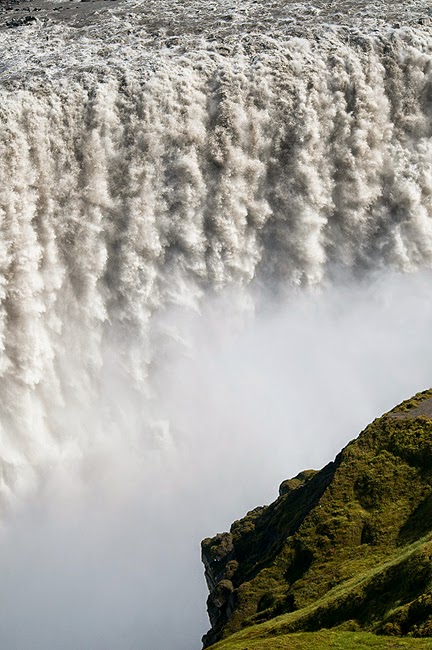
selfoss as well as dettifoss are impressive waterfalls. but because dettifoss is larger and more powerful (most powerful waterfall in Europe!), very dynamic and roars like thunders! for this reason selfoss in kinda in the shadow of his bigger brother, but to be honest it also is beautiful and worth seeing.
 
 
* lake myvatn area is famous of great quantities of annoying flies. sunrise to sunset they try to get into your ears, eyes, nose and mouth. seriously, Icelandic flies are extremely annoying (thou they dont bite!). we were ready for them, took midge-nets we use at home in Scotland in the summer. somewhere I actually read that in Iceland -its windy. oh yes, it is! and the wind blows hard! but as soon as it stops, the flies attack. I dunno, but I deal better with wind!


selfoss 


selfoss


 dettifoss


SKUTUSTADIR PSEUDOCRATERS

okolice jeziora myvatn, kolejna odslona, tym razem pseudokratery w skutustadir. dlaczego PSEUDO kratery? bo nie sa to 'prawdziwe' wulkaniki! poludniowy rejon jeziora myvatn oraz wysepki na tym jeziorze sa wlasnie bardzo bogate w te formy lawowe. ciekawe!
 
.
.
 
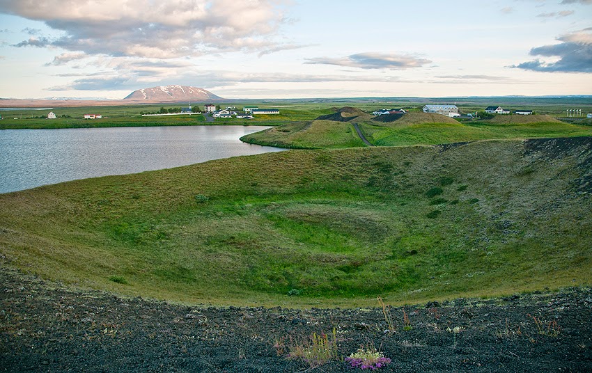
lake myvatn area, another feature - pseudocraters in skutustadir.
why PSEUDO-craters? well, these are not 'real' volcanoes! lots of these lava forms in southern area of lake myvatn and on islands on the lake
how weird!


skutustadir       wioska / village


pseudocratery na wysepkach na jeziorze
pseudo-craters on islands on lake myvatn


Tuesday, 29 July 2014

HVERIR

kolejna bulgoczaco bagnista I siarkowata okolica, bardzo dobra atrakcja turystyczna, ale my juz mialysmy szczerze dosyc tego smrodu wiec popatrzylysmy tylko z daleka.
znajduje sie nieopodal viti&krafla, wejscie 800isk.
 
.
.
 
another boiling mud puddles and sulphur smoke area. apparently it's one of the best but we already had enough of stinky air and just checked it out from afar.
located near viti & krafla, admission 800isk